Acre for acre, Mount Tamalpais might just be the best-loved peak in the San Francisco Bay Area. If so, it’s not because of scale. At 2,571 feet, “Tam” is far down the list of regional high points. Ruggedness doesn’t explain the attraction, either; other peaks are craggier. Wildness doesn’t explain it. With its many roads and reservoirs, not to mention its hordes of cars and hikers, the Tamalpais neighborhood is much tamer than the slopes of Mount Diablo, say, or Mount Saint Helena.
Remember, they are an exotic species in the Western United States, and are rapidly increasing their geographic range and range of habitats. Are they outcompeting or excluding native species in the process? How would we know? We have done almost nothing to monitor changes in the assemblage of mushroom species in areas before and and after the incursion of death caps.
Further Reading
Pringle et al, “The ectomycorrhizal fungus Amanita phalloides was introduced and is expanding its range on the west coast of North America,” Molecular Biology 2009
Lockhart et al, “Simultaneous emergence of multidrug-resistant Candida auris on 3 continents confirmed by whole-genome sequencing and epidemiological analyses,” Clinical Infectious Diseases 2017
Battalani et al, “Aflatoxin B1 contamination in maize in Europe increases due to climate change,” Scientific Reports 2016
Mount Tamalpais: A Mountain of Stories
A Mountain of Stories was produced by Bay Nature magazine with the generous support of the Tamalpais Lands Collaborative for publication in the October-December 2017 issue of the magazine. Read more stories from the mountain:
- Meet Mount Tamalpais, by John Hart
- Nature and Culture Mix in a Theatre Among the Oaks, by Claire Peaslee
- The Nature of the Dipsea Race, by Alisa Opar
- Alice Eastwood and the Plants of Tamalpais, by John Hart
- On the Hunt for Mount Tam’s Two Known Badgers, by Mary Ellen Hannibal
- Snorkel Surveys Reveal the World of Mount Tam’s Creeks, by Ariel Rubissow Okamoto
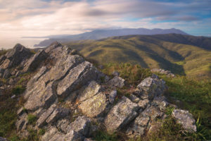
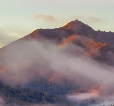
But Tam is close to a great many people, and this hillock is sculpted to call attention to itself. Many Bay Area peaks show themselves to us as long ridges, seen from the side. Tamalpais lies across the grain of the hills, its east peak breaking off abruptly toward San Francisco Bay. The mountain mass is foreshortened into a cone you might imagine is a volcano, its hulking frame visible from much of Marin County and the East Bay.
Also, we have a kind of boiling-down of beauties: great variety in a small compass. On some 60 miles of state park trails the landscape is always changing, near and far: from city to sea to inland lakeshore, from fog to sun, from intimate to expansive and back again. When you’re in the shade of the conifers, they seem likely to go on forever; but five minutes later you will be walking in an open meadow with running springs, or on a serpentine patch, seemingly barren but rich in unfamiliar flowers. Biotic communities fluctuate with soil, elevation (the upper slopes, above the fog, are typically drier), and orientation to the sun.
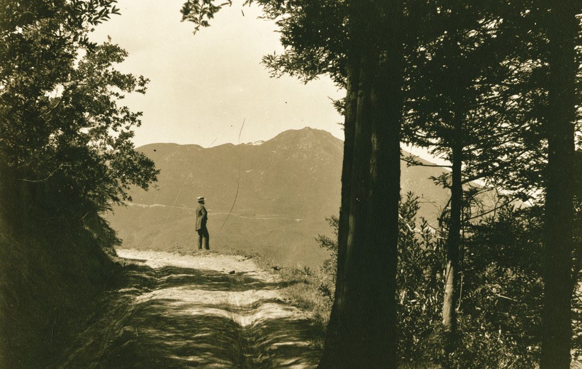
Tam was among the first high points in the region to draw tourists. Between 1896 and 1929, the Mill Valley and Mount Tamalpais Scenic Railroad, “The Crookedest Railroad in the World,” took guests to a summit hotel. Even as cars became popular in subsequent decades, hiking clubs claimed the mountain as their strenuous playground.
This was also one of the very first spots in the region to attract the ardor of conservationists. The pioneer champion was William Kent, a patrician, progressive Republican leader who dreamed of turning the whole of the privately owned mountain into a public park. “Need and opportunity here are linked together,” Kent told the conservation-star-studded initial gathering of what he christened the Tamalpais National Park Association. “What would New York or Chicago pay for such an opportunity?”
That was in 1903. In 1905, his resolve was tested at the place then called Sequoia Canyon, a moist, wind-sheltered valley on the mountain’s southern flank that still held a stand of towering virgin redwoods. By the turn of the 20th century, such groves had become rarities. Now long-delayed logging threatened it. Other options exhausted, Kent stepped forward to buy the land himself. Then a local water company tried to seize the canyon as a reservoir site, so William and Elizabeth Kent donated the heart of the parcel’s redwood forest to the federal government. In 1908, President Theodore Roosevelt declared it a National Monument. Kent insisted that the new park bear the name of famous conservationist John Muir.
The next piece of Kent’s park plan was carried out by indirect means. In 1912, with his backing, a public vote established the Marin Municipal Water District to replace private water companies. In the next several years, the district bought up the long, verdant canyon of Lagunitas Creek on the opposite side of Tamalpais. The water district domain has provided drinking water and secondarily functioned as parkland ever since.
Muir Woods National Monument and the water district lands did not adjoin. In the 1920s, subdivision threatened to keep them separate forever. Kent, the Tamalpais Conservation Club (which he had helped to found), and the state joined forces to plug the gap with a new preserve, which in 1928 became Mount Tamalpais State Park.
The next pulse of preservation came in the 1950s and ’60s, with a new ringleader: Edgar Wayburn of the Sierra Club. Thinking not in terms of trees but of watersheds, the courtly San Francisco physician and his wife, Peggy Wayburn, set out to protect the whole ocean-facing side of the mountain. His campaign succeeded in more than tripling the size of the state park before refocusing on a grander goal: creation of a vast greenbelt to be called the Golden Gate National Recreation Area. Authorized by Congress in 1972, the GGNRA would amass the remaining undeveloped parcels on the Tamalpais coastline.
Something resembling Kent’s desired Mount Tamalpais National Park had in fact come into being. Or had it?

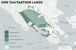
Seventy years of effort had produced not one park but several, with several custodians: the National Park Service, the Marin Municipal Water District, the California Department of Parks and Recreation, and (after 1972) the Marin County Parks’ Open Space District, which acquired important peripheral lands. Hikers and other trail users barely noticed these boundaries, but for bureaucrats they were real. Cooperation certainly occurred, but by special effort, and it ebbed and flowed with changing personnel.
Over the decades there were stirrings toward consolidation. Records show bids to shift Muir Woods to the state, water district land to the state, Mount Tamalpais State Park to the federal government. None of these transfers occurred.
Yet the need for joint effort was obvious, and nowhere more than along Redwood Creek, the stream that flows among the Muir Woods redwoods, where the preservation story had begun. A drop of water rolling off a shoulder of Ridgecrest Boulevard on the spine of Tamalpais finds itself first in Mount Tamalpais State Park, then on water district land, then in the state park again, then in the National Monument, then once more on state land, before reaching the sea in the GGNRA.
By the turn of our century it was clear that this supposedly preserved watershed was in trouble. Soil erosion was a problem. Coho salmon, once the pride of Muir Woods, were in decline. Exotic plant species were spreading alarmingly. These problems were beyond the reach of any one manager.
In 2003, the land managers teamed up with each other and the Muir Beach community to produce a foundational document called “The Redwood Creek Watershed: Vision for the Future.” But it took a state budget crisis to bring about deeper change. In the dark days of 2012, when it looked as if Mount Tamalpais State Park would have to close, GGNRA General Superintendent Frank Dean made an unprecedented proposal: to support the state park with a two-dollar increase in the Muir Woods entry fee. With that, old barriers crumbled.
During this time, the Marin Municipal Water District and Marin County Parks were each independently exploring the creation of a friends organization comparable to the Golden Gate National Parks Conservancy that supports the GGNRA. But with so many groups in the field, so many good causes jockeying for money, was there really room for more? A wider conversation began.
Remember, they are an exotic species in the Western United States, and are rapidly increasing their geographic range and range of habitats. Are they outcompeting or excluding native species in the process? How would we know? We have done almost nothing to monitor changes in the assemblage of mushroom species in areas before and and after the incursion of death caps.
Further Reading
Pringle et al, “The ectomycorrhizal fungus Amanita phalloides was introduced and is expanding its range on the west coast of North America,” Molecular Biology 2009
Lockhart et al, “Simultaneous emergence of multidrug-resistant Candida auris on 3 continents confirmed by whole-genome sequencing and epidemiological analyses,” Clinical Infectious Diseases 2017
Battalani et al, “Aflatoxin B1 contamination in maize in Europe increases due to climate change,” Scientific Reports 2016
Health Report

The agencies that care for Mount Tam — collectively referred to as the Tamalpais Lands Collaborative — convened 60 scientists in 2016 to grapple with the question: How healthy are the plant communities and wildlife living on Mount Tam? In answer to the question they produced a seminal report Measuring the Health of a Mountain: A Report on Mount Tamalpais’ Natural Resources.
Overall, Mount Tam’s natural resources are in “fair” condition. Scientists found that some of the mountain’s plants and wildlife are thriving, while others have been displaced by invasive species, suffer from plant disease, fewer fires, and climate change. There are other species whose condition remains largely unknown, and in 2017 the TLC began collecting data to fill those gaps.
The report provides a baseline of data from which scientists can track the changes — improvement, stasis, and decline — and make better-informed decisions about Mount Tam’s health.
The time for a mountainwide partnership had come, yet its creation was no easy matter. The four agencies had different mandates, different cultures. Kevin Wright of Marin County Parks observes, “We might well have said at some point, ‘This doesn’t work, we’re just too different.’”
It was also vital to bring along all those passionate groups and individuals who felt themselves guardians of the mountain and had firm ideas about what should and should not happen there. Countless meetings were held even before the final form of the collaboration was unveiled.
Another skull-cracker was how to define “Mount Tamalpais.” Geologically? Ecologically? By jurisdictions? By public perception? The “area of focus” that emerged from these discussions was “a hybrid of all these together,” says the Parks Conservancy’s Sharon Farrell. It goes well beyond the core of the mountain mass, finally comprising more than 53,000 acres, or 80 square miles.
After two years, on March 21, 2014, a memorandum of understanding created a formal alliance of the four land agencies along with the Golden Gate National Parks Conservancy, called the Tamalpais Lands Collaborative (TLC). It would work with the community under the banner “One Tam.” The conservancy raised a million dollars in seed money, and the work of refining the vision and picking priority programs and projects began.
Three years later, the record is impressive. The TLC has been able to offer regular staff support, for the first time, to youth and community programs, volunteer restoration work, and citizen science throughout much of the One Tam area. It published the first free, multi-agency trail map of the region, together with the sixth edition of Barry Spitz’s guide now renamed Mount Tamalpais Trails. In further aid to recreation, it is updating and improving trail signage across the region. TLC’s website is remarkable for its clarity and openness—project and program budgets and actions are routinely posted there—with a stunning interactive image of the mountain to which people can pin remarks and photographs (one.tam.org/explore). A prime illustration of the agencies’ joint strength is their offensive against invasive species: They’ve engaged both volunteers and paid workers and set up an Early Detection Rapid Response program—167 miles of roads, trails, and streamsides have been screened and all of the known high priority patches are being managed. The TLC has also installed the continent’s largest array of automated wildlife cameras, yielding more than a million images, collected and catalogued by some 125 volunteers. But perhaps the proudest moment for the partnership so far was the release, late in 2016, of the comprehensive report called “Measuring the Health of a Mountain,” also available in boiled-down form under the title “Is Mt. Tam at Peak Health?”
The peak health report goes back to questions the TLC encountered as it was reaching out to supporters and volunteers. As Farrell recalls, people asked, in effect, “Great, but what are we actually doing this for? Is Mount Tamalpais in trouble?”
In trying to answer that question, the TLC undertook something new for California and rarely attempted anywhere (except for certain well-studied wetlands): the creation of a baseline inventory of the biotic condition of an entire substantial region. Excited by both the place and the concept, scientists from all the involved agencies, Point Blue Conservation Science, and the larger Bay Area proved avid to take part.
Peers from other areas cautioned against waiting for new research, advising, “Take advantage of what you’ve got.” Accordingly, the team proceeded by distilling huge troves of existing data, building a mosaic from prior work on species of high concern, like the northern spotted owl and the foothill yellow-legged frog, and on broader communities, like grassland or redwood forest or coastal scrub and chaparral.
And the diagnosis? Mixed. Some species and communities on Tam are holding their own very well; some are declining, but still in a state where modest interventions can make a big difference. In a natural world that is rapidly changing, and rarely for the better, we can only welcome the tentative overall verdict: “cautionary, but fairly stable.”
Important though it already is, this work will show its full value in the future, as reassessments every five years track the landscape’s evolution and provide better guidance for the many willing hands and minds devoted to this mountain.

