January 2023 marks the 30th anniversary of the Trails Challenge—a beloved annual tradition that helps people of all abilities access the vast East Bay Regional Park District and inspires them to get outside.
The Challenge: walk, roll, bike, or ride at least five trails or complete 26.2 miles by December 2023. As you go, track your progress, and once you’ve hit your mark, submit a log, electronic or paper, of your accomplishments to the park district to receive a commemorative pin and T-shirt. No registration is required, there is no participation fee, and you move at your own speed. It’s all on the honor system. “The model is to empower people to say, ‘I can do this,’ but [on] their own schedule and convenience,” says Tiffany Margulici, the park district’s acting chief of Interpretive and Recreation Services.
Visit the EBRPD’s Trails Challenge page to learn more, including:
• The 2023 guidebook: How to access it online and where to pick up a paperback copy
• The AllTrails app and how to copy maps and details about this year’s trails to your smartphone
• Getting a Trails Challenge Log Form to track your progress through the year
Each year the park district, in partnership with the Regional Parks Foundation and Kaiser Permanente, publishes an online and print guidebook designed to help you choose a trail to fit your ability and interest. It features 20 different regional parks, highlighting specific trails. This year includes traditional locations such as Tilden Regional Park, Black Diamond Mines Regional Preserve, Pleasanton Ridge, and the newly constructed Dumbarton Quarry campground as a staging area for trails in Coyote Hills Regional Park.
The featured trails are categorized as easy, moderate, or challenging, determined by a combination of terrain, elevation, and distance. Many include scenic destinations: breezy shorelines along a salt marsh or with the fresh scent of eucalyptus woods (Oyster Bay and Point Pinole Regional Shorelines), ridgetops-with-views perched on old ranchland (Vargas Plateau Regional Park), and rolling steep grasslands (Round Valley Regional Preserve). But you can use any trail route within the East Bay Regional Park District, not just those listed in the guidebook, to complete the challenge. The pages also offer tips, guidelines, and maps to make your park experience safe and enjoyable.
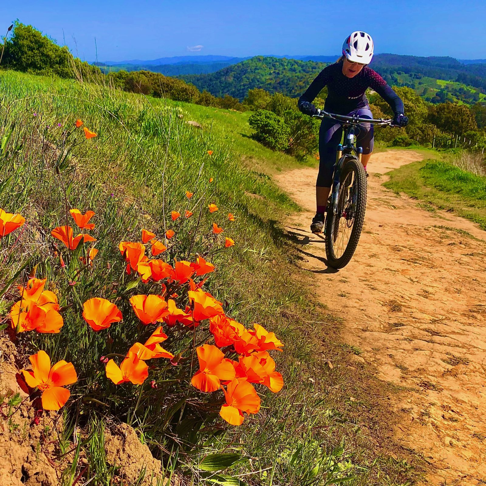
Biker at Bay Ridge Trail in Anthony Chabot Regional Park in early Spring 2020. (Photo by Austin McInerny, @coach_bobo_rides)
The Challenge aims to get people out of their routine visit to a favorite trail to instead explore some of the other 73 parks in the park district, which spans 125,000 acres. “Hundreds of thousands of people come to the parks every year. During COVID, when we were in the shelter-in-place, Coyote Hills got even more popular than it was,” says Mike Moran, regional interpretive and recreation services manager of the North/West Region. “We realized the earliest success of this program is that we could spread the word about some of our lesser-known gems … It also spreads out use to lesser-used trails.”
The Challenge also promotes the connection between being in nature and community health. The park district has been a member of the Healthy Parks Healthy People movement since June 2012. HPHP is a global campaign that encourages active outdoor fun along with appreciation and taking care of our parks and open space areas. Healthy parks sustain healthy people.
Kaiser Permanente, a Trails Challenge sponsor since 2005, has been key to the program’s growth. “They’ve provided funding to make it a free program. Before that, it was reasonably priced, but having a free program reduces one more potential barrier,” says Margulici. “We [are] able to reach a lot more people.”
How it all comes together
Organizing the Trails Challenge takes many hiking boots over the majority of the year, with many environmental considerations. Planning starts in January with trail selection. Recommendations and suggestions come from around the park district: visitor centers, naturalists, recreation leaders, and rangers. “[We] start with making sure we have trails throughout the park district we’re going to feature, then narrowing down what we’ve used in the past few years and what new parks might be opening,” says Kelsey Gielen, outdoor recreation supervisor. The park district is continually looking for new trails to give users variation.
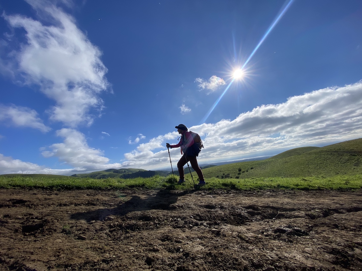
The Interpretive and Recreation Services Department scouts or “ground-truths” at least 30 trails every year. Roughly 40 scouts, a mix of staff and volunteers, rate each trail’s difficulty and write up descriptions. There is a minimum of two scouts for each trail, sometimes a third if the route changes.
Fire season and climate change impacted some scouting plans in 2022. However, reviews are done as early as possible in the year, while the accompanying photos can give people a glimpse of the vistas and beautiful natural features in the park.
Park supervisors double-check their park’s information for the guidebook to note any safety concerns or construction hazards. Then, the department can work with supervisors to address issues if, say, a tree has fallen across a trail or there’s a piece of chunked-up pavement that needs to be replaced. Ground-truthing ensures visitors can confidently immerse themselves in this self-guided program.
“We get to check the trails ourselves for accessibility or mention barriers that can be there for users. It keeps our trails safe because we’re scouting regularly and featuring them, making sure that they’re well maintained,” says Megan Seccombe, recreation coordinator for the park district.
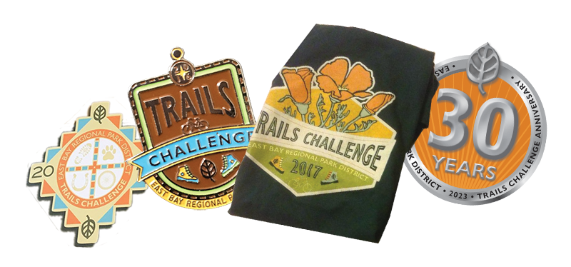
The list of trails is whittled down and submitted to the Public Affairs Division, which handles the design of the annual logo, guidebook, pin, and T-shirt. Many participants collect the annual memorabilia, which has become the park district’s rendition of the National Parks’ Passport to Your National Parks program. “We get 10,000 people a year doing this program for 30 years. It’s successful. It’s a subculture all unto itself,” says Moran.
But the district is not resting on its laurels. It’s a delicate balance to meet the needs of all park users, from bicyclists and skateboarders to horseback riders and people seeking dog-friendly locations, and park staff and leaders are continuing to evaluate how to make the parks more broadly appealing.
A trail for everybody
More inclusivity is a goal as well: this year’s Trails Challenge guidebook will include two pages of park accessibility details. Rather than working in a vacuum, the park district reached out to experts in the field: the Bay Area Outreach Recreation Program (BORP), a Berkeley-based nonprofit with a mission to provide sports, recreation, and fitness programming for children, youth, and adults with physical disabilities and visual impairments.
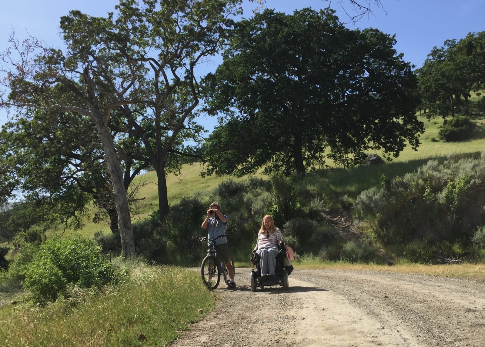
Bonnie Lewkowicz, director of BORP’s Access Northern California program, which has a website providing resources on trails, parks, and gardens, has been working with the park district to improve accessibility information. Scouting the parks, she provides descriptions on the ANC site of over 25 accessible trails in the park district from the perspective of someone in a motorized wheelchair. The guidebook will list the accessible hikes for this year’s Trails Challenge and will recommend that readers visit the ANC website for more trail ideas.
“There are about 25 to 28 parks [in the park district] that consist of paved trails, fully accessible restrooms, parking, and picnic sites,” says Seccombe. “I think it’s really important to mention for users with varying abilities because a lot of the hikes that we do feature aren’t always accessible. So giving those users variety is really important for inclusivity.”
Access means different things to different people. Someone using a walker versus a pair of crutches or a stroller will determine what is easy, moderate, and challenging according to their needs. Currently, the park district defines the categories by distance and elevation gain. But when it comes to accessibility, other trail qualities, like the surface, grades, and steepness, come into play.
“I developed a survey from my knowledge of the ADA [Americans with Disabilities Act], as well as Title 24 [California and federal regulations on accessibility for people with physical and sensory disabilities]. I personally visit the outdoors a lot and go with other people with other types of disabilities,” says Lewkowicz.
Her survey serves as an accessibility inventory of a park, informing readers about its usability, with questions like “Are the visitors’ center and bathrooms reachable by an accessible path? Does it have a level or ramp entry? Does the picnic table have at least 27 inches of knee clearance? Are they located on a level, firm, and stable surface?”
“I’ve taken to starting out the description saying that ‘this trail was reviewed by someone in a rear-wheeled motorized wheelchair’ because that gives people more information: ‘Can I do this in a manual chair? Well, someone did it in a motorized chair and called it difficult, so I might not be able to do it in a manual wheelchair.’” She breaks down the type of terrain, ranging from hard-surface (paved, boardwalk, asphalt, brick) to very soft (problematic for manual wheelchairs and possibly for motorized wheelchairs and scooters), and gives information on slope, from trails a manual chair can negotiate to others that are very steep and dangerous without assistance.
Lewkowicz would like the idea of “accessibility” to be more expansive and not just conjure wheelchairs in people’s minds. To her, it’s about creating usability for those who are blind, autistic, or use other mobility devices or who have non-apparent disabilities that limit what they can do.
“I think the biggest thing people with disabilities want is access to the same experiences,” she notes. “Hand-cycles with motors are enabling people to go farther and on rougher terrain. I don’t want other people’s lack of imagination to be my barrier.”
Get inspired
You don’t have to wait until the park district schedules a program to get outdoors. The Trails Challenge is a gateway to making trails a part of everyday life and reaping the health benefits of being in nature. It opens opportunities both for people new to the regional parks and for seasoned hikers.
“Try something new, but try it with different people,” suggests Moran. “Get a larger group of people who might take a slower pace. Try to view the park in a different way. Spreading it out over the year allows people to do it at their own pace, to see parks in different seasons and times of the day. It can give you a completely different experience, something novel and exciting or calm.”
He wants people to remember: These are your parks. These are your taxpayer dollars at work. Come out, steward, and enjoy them.
