For more than a decade, a team of environmental partners carefully planned a strategy to open up nearly 9,000 acres in the remote Santa Cruz Mountains for recreation, research, and timber harvesting.
In a fiery instant, that plan got much harder. And more interesting.
Newly opened San Vicente Redwoods proves that nature is forceful and surprising and can upend everything—but that it can also open our eyes to opportunities, if only we give it a chance.
The place is “a living laboratory,” where scientists will learn from the forest’s response to the massive 2020 CZU Lightning Complex Fires, subsequent restoration efforts, and human visitors, says Ian Rowbotham, senior land stewardship manager for Sempervirens Fund, which co-owns the property with Peninsula Open Space Trust.
New trails for hikers, bikers, dogs and horses
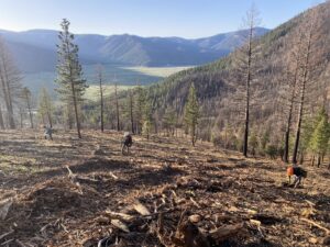
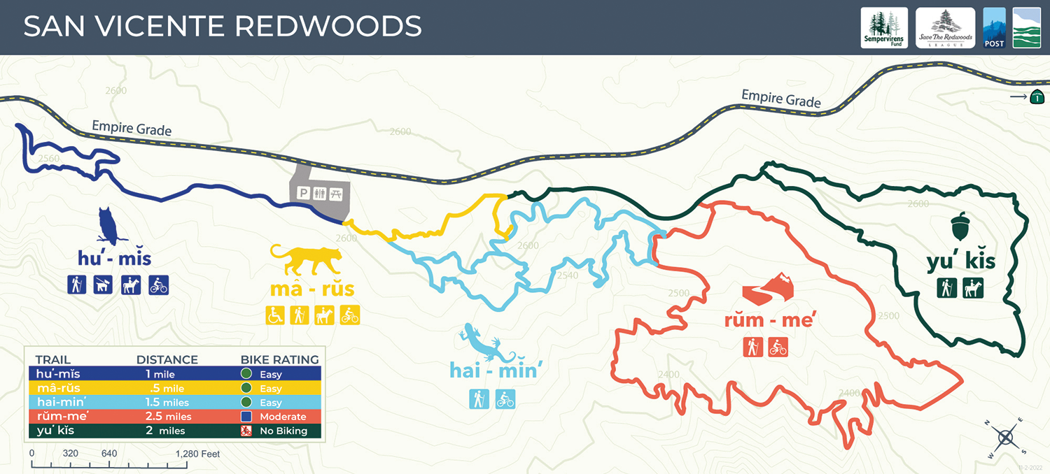
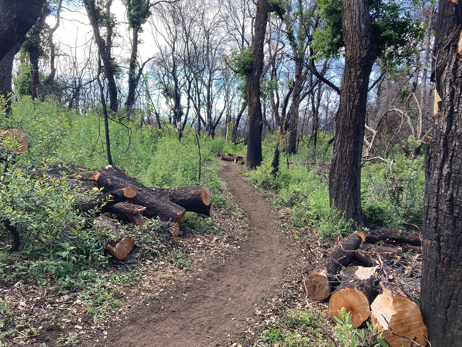
A soft layer of ash cushions the 7.5 miles of looped trails, which weave past charred boulders and skeletal Douglas fir, black and contorted. The route starts flat at the top of Ben Lomond Mountain, then steepens as it descends a ridge that divides two critical coastal watersheds.
Map courtesy of Vicki Lowell
But the forest is being reborn. Where tanoak had burned down to dead stubs, thickets of yerba santa, bush poppy, and ceanothus are now sprouting. Already, scientists are tracking wildlife, measuring plant growth, and monitoring creeks. Loggers, driving flatbed trucks, carry sustainably harvested lumber to market.
Of the new trails, all are open to hikers, with 4.1 miles designated for biking, 2.3 miles for horseback riding, and one mile for leashed dog walking. Trail signs, written in both English and Awaswas language—spoken by the Amah Mutsun Tribal Band, whose ancestors first lived in the area—offer guidance. It’s private property, so visitors are required to register and carry a pass.
Construction on another 30 miles of trails will start within the next three to five years, hopefully linking the park to the adjacent Cotoni–Coast Dairies National Monument, whose marine coastal terraces overlook the Pacific Ocean.
Restoring the land
This land has been off-limits to the public for over a century. Clear-cut by logging, with portions disfigured by mining, it was owned by CEMEX, which had a now-shuttered cement plant in Davenport, until 2011. A smaller portion of land was added to the property more recently, with the purchase of a cattle ranch that was a filming location for the 1917 Cecil B. DeMille silent film A Romance of the Redwoods.
Four Bay Area–based nonprofits—Peninsula Open Space Trust, Sempervirens Fund, Save the Redwoods League, and the Land Trust of Santa Cruz County—united in a vision to manage and restore the damaged land.
With care and patience, the groups mapped out a three-pronged plan. For recreation, the property would offer a variety of trails to meet the very different needs of hikers, equestrians, cyclists, and dog walkers. For research, it would invite data-driven projects. To create revenue and build a healthier forest, it would host sustainable harvesting and restoration.
Designers got to work. Public trails would be limited to a narrow corridor, they agreed, to protect puma habitat and leave the forests untrammeled. Trails would be dedicated to specific activities—dog walking versus horseback riding, for example—to prevent conflict. The designers identified the most scenic vista points and crafted each trail to minimize erosion, marking them with small flags.
“The project was just about shovel-ready,” recalls Brian Homberger, public access manager for the Land Trust of Santa Cruz County.
A consequential fire
Almost overnight, the CZU Lightning Complex Fires changed everything. Ignited by a historic lightning siege, they torched a region that hadn’t burned in years, destroying 1,490 structures and blackening 86,509 acres of land, including San Vicente Redwoods.
“Every inch of this property burned at varying intensities,” says Justin Garland, redwoods program manager for Peninsula Open Space Trust.
The park’s plan still held. But suddenly there were new challenges.
“If you take all the complexities that were already on this property around managing all the various things we were doing, and then overlay that with this fire, it threw everything that we thought we knew up in the air,” Garland says.
“We’re still learning, and still adapting,” he adds.
Opening to the public was delayed, and costs climbed. About 1,200 now-dangerous trees were felled. Almost all of their wildlife cameras were damaged and needed replacement. Trails had to be re-flagged, with some routes changed to avoid unstable slopes or other hazards.
No longer protected by shade, trail builders worked in heat, under harsh sun, with poor footing. It took an hour, on average, to build 10 feet of trail; a long rock wall could take a day, depending on the terrain. The ash was hard on equipment engines. Wheelbarrows sank into deep dust.
“Any sort of soil disturbance meant we had to wear a dust mask,” says Jacob Hyde, trails superintendent of the Santa Cruz Mountains Trail Stewardship, which managed the project. “The fire just made it a really hard place to work well.”
An opportunity to witness regrowth
But the fire also delivered a stroke of good fortune.
The ground is erupting into a canvas of bright green. Devoid of dense forest canopy, the mountains’ graceful contours can be easily viewed. Woodpeckers hammer, scanning dead wood for insects. Newly built bridges span deepened ravines, inviting visitors to linger and look.
A native and beautiful fire-following flower, called red rayed hulsea (Hulsea heterochroma), has been noted in the region for the first time in recent history. The endemic and threatened Santa Cruz manzanita (Arctostaphylos andersonii) flourishes in the park’s open meadows. The old Mill Creek Dam was demolished after the fire melted a waterline, so sediments and water now flow more freely.
The burned landscape offers new educational opportunities. Some interpretive panels describe the importance of fire for a healthy forest. Other panels are erected under seven skeletal Douglas firs, explaining why snags offer wildlife habitat.
About 3,500 acres of the park are set aside for commercial timber harvesting, generating revenues to help support the property. Another 4,000 acres are part of a forest restoration project, with strategic thinning to let iconic redwoods regain their dominance. Thousands of new seedlings have been planted. Shaded fuel breaks are under construction, where low branches and the forest floor are cleaned up to reduce threat.
Visitors can witness the response of this burned forest, one of nature’s least understood and most dynamically changing habitats. “There is a big opportunity here to introduce the public to what it takes to manage property,” Homberger says, “and what it takes to create a fire-resilient landscape.”
An earlier version of this story erroneously stated that trail sign names are written in English and Mutsun. They are written in English and Awaswas.

