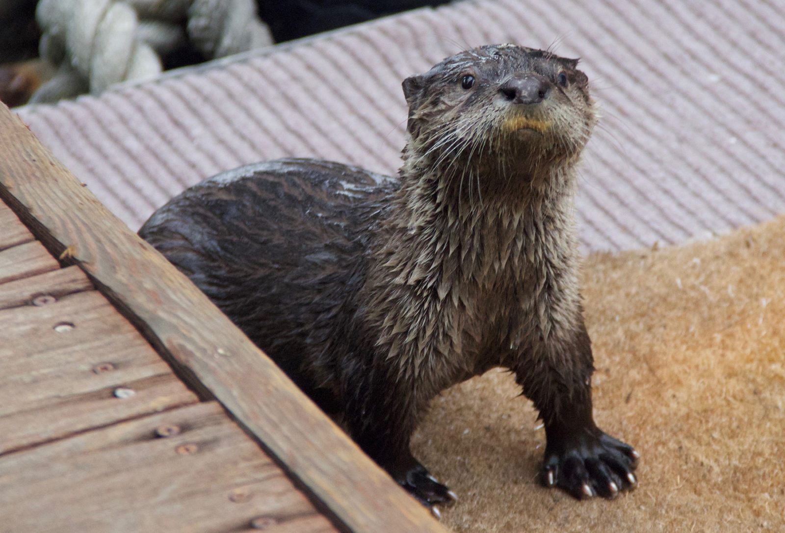
I live in South San Jose and years ago there was a family of river otters living in Coyote Creek. With the years of drought we had and the fact that Coyote Creek and the ponds nearby all went dry, what happens to river otters? Do they die off or are they smart enough to make their way to the ocean or possibly something else? It saddens me to think they died. Thank you – Glenn Bohannon, San Jose
I’m happy to say the otters had a very good chance of surviving the drying of their home streams. Your question brings up one of River Otter Ecology Project’s major research areas and highlights the important role community science plays in our understanding of local watersheds.
When creeks and ponds dry up otters move on to better habitats. They often follow waterways, whether rivers, streams, ponds, or lakes, coastlines or bays. Unlike sea otters, river otters are agile on land, can climb trees and move 25 miles or more between watersheds. They seek a source of fresh water, to drink and help groom their thick fur, and good supplies of prey. Otters are carnivores, not picky, and their prey includes fish, crayfish, insects, birds, and herps. The otters you mention may have headed toward the Bay or they could have moved toward nearby bodies of water.
While otters are well able to move around to improve their habitat choices, they face significant barriers when they live close to large cities like San Jose. Their greatest barriers are highways … otters get hit by cars with alarming frequency. We collect otter mortality sightings on our website, and share that information with the California Roadkill Observation System. An understanding of hotspots where otters are being hit by cars is helpful in designing underpasses to help wildlife survive. Populations can be adversely affected by barriers like this, not just as individuals, but because these barriers can behave as bottlenecks, reducing the mixing between populations that strengthens genetic diversity. Otters also require habitat connectivity between water bodies and upland areas where they tend to have natal dens. The ability to get back and forth between hunting grounds and their pups in a den is crucial to survival of the young.
Our experience monitoring an otter population using reclamation ponds at Mt. View Sanitary District in Martinez indicates that otters are well able to thrive going back and forth beneath the six-lane Interstate 680, using both a slough and a culvert, and are quite able and willing to use either one as circumstances require. There are solutions to barriers to wildlife health, and we humans are learning to find and use them.
We’re especially interested in your information because we don’t know much about otter populations in the South Bay, nor do we know the southern extent of their range in the San Francisco Bay Area. This year, ROEP is extending our outreach into the South Bay to answer just those questions. Public observations are very welcome! We know there are river otters thriving in Coyote Hills Regional Park in Fremont, but south of Fremont we don’t have reliable information about where river otters are or have been in the past.
Our “Otter Spotter” program solicits otter sightings from the public, maps them and makes them available to anyone with an interest in where otters are found in the SF Bay Area and beyond. The information is used to inform agencies like the CDFW, OSPR, restoration managers, wildlife rehabilitation groups and state, national and local parks.
If you take a look at the sightings map on our website, you’ll see that we’ve had many river otter sightings in the North and East Bay. We’ve received a few sightings in San Jose and Los Gatos; however, none of the sightings included photos and we cannot be positive they’re otters. We would be delighted if everyone in the South Bay keeps their eyes open for otters and has their phone ready for a quick photo if you see one! It’s easy to submit a sighting; just tap on over to riverotterecology.org, click on the Otter Spotter icon and fill in the form. Be sure to upload photos too!
Community science (some call it citizen science) is the basis of our Otter Spotter program, and we appreciate it tremendously. Thanks to the sharp eyes and documentation of our hundreds of Otter Spotters during the past six years, we’ve received more than 2,500 otter sightings and changed the river otter range map for California. The CDFW is preparing a new range map including this information and that of other otter researchers, and we hope to see it online soon.
Please take a look at our website for maps, descriptions of otters, photos and videos to help with your identification. And look for us on Instagram, and on Facebook, where we post the most fun videos from our extensive camera trapping project.

Ask the Naturalist is a reader-funded bimonthly column with the California Center for Natural History that answers your questions about the natural world of the San Francisco Bay Area. Have a question for the naturalist? Fill out our question form or email us at atn at baynature.org!


