The East Bay Regional Park District and other parks agencies own and operate an impressive array of shoreline parks in the East Bay. Visit a different one every week, and you’d still be busy for at least four months. Here’s a near-comprehensive list:
Brooks Island
373-acre island just off the Richmond Inner Harbor shore. Features Indian shellmounds and burial sites, heron and egret colonies, and tern nesting site. Open only by reservation for limited group guided tours (call 510-636-1684). (Certain areas are off-limits during nesting season.)
Visitors must supply their own boat transportation and personal safety equipment. Facilities are minimal.
www.ebparks.org/parks/brooks_island
Cesar Chavez Park
11 Spinnaker Way, north of the west end of University Avenue, Berkeley
90-acre park including wheelchair-accessible trails, wetlands, and a wildlife refuge. Also features picnic areas and spectacular views of three bridges.
www.ci.berkeley.ca.us/parks/parkspages/CesarChavez.html
Crown Memorial Beach
Eighth Street and Otis Drive, Alameda
Crab Cove Visitor Center: 1252 McKay Avenue, Alameda
2.5-mile beach bordered by sand dunes and lawns.
Features swimming (no lifeguards on duty), picnic tables and barbeque pits, windsurfing, Elsie Roemer Bird Sanctuary, Crab Cove Marine Reserve, Crab Cove Visitor Center (disabled accessible), and sand castle/sand sculpture contest each June.
http://www.ebparks.org/parks/crown_beach
Don Edwards San Francisco Bay National Wildlife Refuge
West of Interstate 880 in Newark
30,000 acres of open bay, salt pond, salt marsh, mudflat, upland, and vernal pool habitats located throughout south San Francisco Bay.
Features visitor center, hiking and birdwatching trails, canoe/kayak launch, environmental education center offering interpretive programs for the public and school groups.
Dumbarton Pier
Thornton Avenue off Highway 84, Fremont
Remains of the first automobile bridge across San Francisco Bay. Features pier walk, birdwatching, and fishing.
http://fishit.freeshell.org/dumbarton.htm
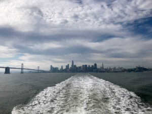
Eastshore State Park
East Bay shoreline between Richmond’s Marina Bay and the foot of the Bay Bridge.
1,817 acres of water and shoreline operated in a partnership between East Bay Regional Park District and the State of California. Features more than 5 miles of public access with spectacular views of the Bay, including portions of the San Francisco Bay Trail. Future development projects include a kayak launch and environmental enhancement for wildlife and native plant conservation. Click here to read more.
www.ebparks.org/parks/eastshore
Emeryville Waterfront Park/Davenport Mini-Park
3300 Powell Street, Emeryville
Features pier fishing, grassy picnic areas, Bay views.
Hayward Regional Shoreline
3010 West Winton Ave., Hayward
1,682 acres, including 400 acres of restored seasonal wetlands and salt, brackish, and freshwater marshes.
Features 3-mile hiking and bicycling trail.
Martin Luther King, Jr. Shoreline
Doolittle Drive and Swan Way, Oakland (next to Oakland International Airport)
1,220 acres of preserved marshlands.
Features a boat launch ramp, picnic areas with barbeques, a turfgrass playing field, fishing piers, children’s play area, observation platform with wheelchair access, and paved trails.
Swimming is not allowed; dogs must be on leash at all times, as this is part of the Western Hemisphere Shorebird Reserve Network.
Middle Harbor Shoreline Park
Off of Middle Harbor Road, Oakland
38 acres, including nearly three miles of pathways encircling Middle Harbor Basin for walking, bicycling, birdwatching, and observation of maritime activities.
Features wheelchair-accessible picnic areas with barbeques, amphitheater, fishing, and viewing tower.
www.ebparks.org/parks/middle_harbor
Miller/Knox Regional Shoreline
900 Dornan Drive, Richmond
295 acres of shoreline and grassy hills on the Richmond shoreline and adjacent hills north of Point Richmond. Features a landscaped shoreline picnic area with shady lawn, saltwater lagoon, mile-long pedestrian and bicycle trail, swimming beach on the Bay (no lifeguards on duty), shore fishing, kite flying, and hiking trails in the nearby hills with spectacular views in all directions.
http://www.ebparks.org/parks/miller_knox
Oyster Bay Regional Shoreline
North end of Neptune Drive, San Leandro (just south of Oakland International Airport)
New shoreline park offering birdwatching and views of the Bay. Features picnic areas, multipurpose trails, and view site.
www.ebparks.org/parks/oyster_bay
Pinole Bayfront Park
Tennent Road off San Pablo Avenue, Pinole
Picnic areas, wild blooming flowers in season, and wildlife viewing. Features views of San Pablo Bay and connections to the Bay Trail.
Point Isabel Regional Shoreline
West end of Central Avenue, Richmond (adjacent to US Postal Service Bulk Mail Center)
21 acres of park with views of the Golden Gate and Marin County. Features off-leash dog walking, Bay fishing, birdwatching, kite flying, picnicking, commercial dog washing and café facilities, and jogging/running trails.
www.ebparks.org/parks/pt_isabel
Point Pinole Regional Park
Giant Highway, Richmond
2,315 acres of meadows, eucalyptus groves, bluffs, and beaches on San Pablo Bay, with views of Mount Tamalpais, the Marin shoreline, and San Pablo Bay. Features trails for hiking, bicycling, horseback riding and a fishing pier accessible by shuttle bus.
www.ebparks.org/parks/pt_pinole
San Leandro Marina Park
Monarch Bay Drive & Fairway Drive, San Leandro
30-acre park with views of the Bay. Offers picnic areas and connections to the San Leandro Shoreline.